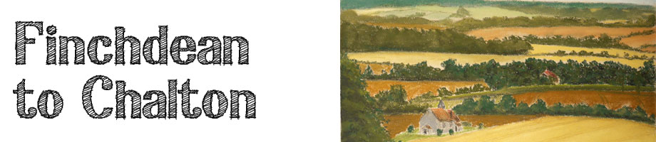
This walk is the middle part of the Staunton Way walk, and to my mind it one of the most enjoyable walks through this part of the South Downs, and the best part of the Staunton Way. It takes you up from Finchdean along the top of the downs heading north, and running parallel to the main railway line from Havant to London. From the top of this hill at 140m high, you can see all round the downs from the Solent in the south to Queen Elizabeth Country Park in the north. The walk then brings you back down the other side of the valley, through the woods, and past the famous church in a field at Idsworth. It is up and down hills, but is enjoyable in any season. Click here to see the whole of Staunton Way. |
|
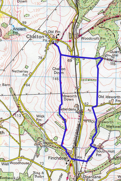
Distance: 9.3 km, 5.8 miles Walking Time: 2 hour 20 mins Difficulty: Moderate Wheelchair Accessible: No Start/End: Village car park Access: |
 |
| Download printable Itinerary |
Download .gpx file |
Itinerary The walk starts from the car park in the middle of the village of Finchdean, opposite the George Inn pub. To reach Finchdean from Emsworth, drive north up North Street and continue out of the village and up to the roundabouts at Rowlands Castle. Turn right and then right again at the two mini roundabouts and down into the centre of Rowlands Castle. Past the green and under the railway bridge, bear left onto Finchdean Road, then after 1km urn left onto Dean Road to the village centre From the car park, head north west up the road past the row of cottages, and where the road bears left, follow the fingerpost and turn to walk along the edge of the field. This path tuns right at the corner of the field, and you start to ascend the hill. You now follow this path continuously as it heads to the top of the own, skirting as copse of trees. Keep the fields at this point on our right hand side. The path meander gently to left and right until it crosses to the left over a stile and across the field at an oblique angle to the left of an electricity pylon and then on through a hedge and over the top of the hill. The path then descends to a junction of three paths and here turn left and down to Chalton church at the centre of the village. If you need a break at this point, visit the Red Lion pub opposite the church in the centre of this lovely village. You now return past the church and up to where you left the field, but this time follow that path that goes straight over to the east across the field. This will bring you to a stile at the top of an escarpment, and the path zig zags down to another stile that takes you onto a road and across the railway. At the T junction, follow the path eastward up the hill and past a farm on your right, until it passes through a copse of trees, and you find a fingerpost to the right pointing to the footpath heading south. Follow this path until you come to a road at right angles to the path. Cross the road and turn right into the field, which leads round and past St Hubert's Church on its own in the middle of the field. St Huberts is a 9th century church that served a Saxon settlement on this site, which no longer exists. Continue to follow the path south, passing up into a wood, and emerging at the far end of the wood turning left past a farm on your left. Pass the farm and turn right onto the road leading down the hill. You pass a copse of trees and at the edge of the copse turn right onto a straight path that leads down the valley to the west, and through a small tunnel underneath the railway. Follow this path up to the road and you emerge next to the George Inn, and back to the car park. |
|